
Raša Through the Archive: 20 Photographs from Istria’s Mining Century
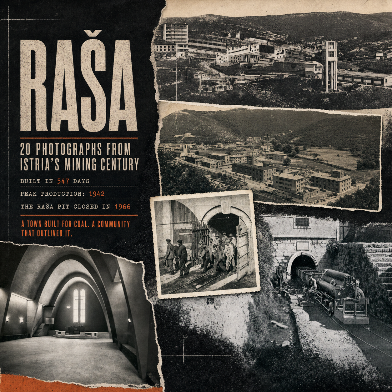
Raša is usually explained through one astonishing fact: a complete mining town appeared in an Istrian valley in 547 days. The fact is true, but it can flatten the place into an architectural curiosity. The archive tells a more complicated story. It shows a valley already shaped by coal, a town designed around work, families living inside a political project, a transport system that reached all the way to the sea, and a community that kept changing after the flags above the square changed.
This visual essay uses twenty photographs from the 22 Estates archive. Some are formal panoramas and postcards; others record mine portals, locomotives, workers, public buildings and damaged infrastructure. Their original labels are not always complete, so the article distinguishes between what the captions identify and what the image itself allows us to see. The photographs are evidence, but they are not neutral. Each one was made for a reason, framed by a person and preserved by someone who believed it mattered.
If you want a conventional introduction to the town’s design and landmarks, begin with our guide to Raša as a planned mining town. Here, the purpose is different: to follow the town through time and learn how to read its surviving landscape through the archive.
Key Takeaways

More Than a Building Story
The photographs connect architecture with labour, transport, hierarchy, war and family life.

A Landscape Built to Move Coal
Portals, narrow-gauge lines, sorting plants, cableways and Bršica formed one industrial system.

The Plan Is Still Legible
The square, housing zones and public buildings remain readable even after their original functions changed.

Workers Made the Town Real
Official architecture photographs show order; images of miners reveal the human system beneath it.

Use the Archive on Location
Walk slowly, compare rooflines and openings, and treat present-day Raša as a layered place rather than a frozen monument.
A Short Timeline Before We Open the Album
Mining around Krapan began long before the new town. The Municipality of Raša’s historical overview traces the first known coal concession to 1626 and continuous production to the eighteenth century. By the early twentieth century, mines, workshops, housing and transport infrastructure had already transformed the valley. The Raša pit opened in 1928; the new town followed when production and labour requirements expanded under Italian rule.
| Period | What changed | What to notice in the archive |
|---|---|---|
| Before 1936 | Krapan, mine portals and transport infrastructure preceded the town. | The valley was industrial before Raša acquired its famous plan. |
| 1936–1937 | Gustavo Pulitzer Finali’s town was constructed and inaugurated. | Housing hierarchy, the central square and complete civic programme. |
| 1942 | The coalfield reached its wartime production peak. | Industrial scale hidden behind the town’s clean façades. |
| Post-1945 | The political meaning changed while coal remained economically vital. | New symbols, busier streets and continuity in everyday use. |
| 1966 onward | The Raša pit closed, while mining elsewhere in the basin continued. | Industrial spaces slowly separated from their original functions. |
1–2: Before the Model Town, There Was a Working Valley
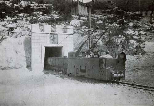
The archive label dates this portal to 1928, eight years before construction of the planned town began. That order matters. Raša was not placed in an empty landscape and then given a mine as an accessory. The settlement followed the industrial system. The portal, rails and small locomotive show the practical geometry from which the later civic geometry grew.
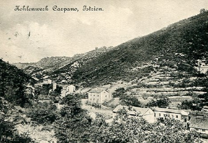
Krapan is essential to understanding that system. Long before Raša became the visual symbol of Istrian coal mining, Krapan had shafts, housing, workshops and generations of mining families. In this panorama, the settlement is not arranged as one architectural statement. It has accumulated around work. Compare its irregular relationship with the slopes to the controlled axis visible in the later photographs of Raša.
3–6: A Town Built Quickly, but Designed Down to the Details
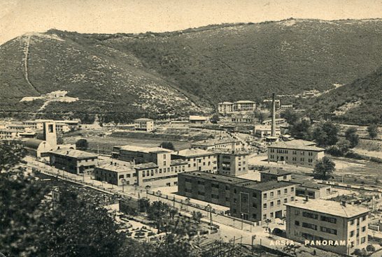
Construction began in late April 1936, and Raša was inaugurated on 4 November 1937. The official local history gives the memorable total of 547 days. Pulitzer Finali and the STUARD studio were responsible not only for the street plan but for public buildings, housing types, interiors and furniture. The result is unusually complete: a town that can be read as one coordinated commission.
The early central view shows why the place could be presented as modern. Roads, planting and crisp building volumes appear settled almost immediately, while the bare slopes expose how recently the valley had been reshaped. The clean image is persuasive, but look at what it leaves outside the frame: the noise, dust, shift changes and dangerous underground labour that justified the town’s existence.
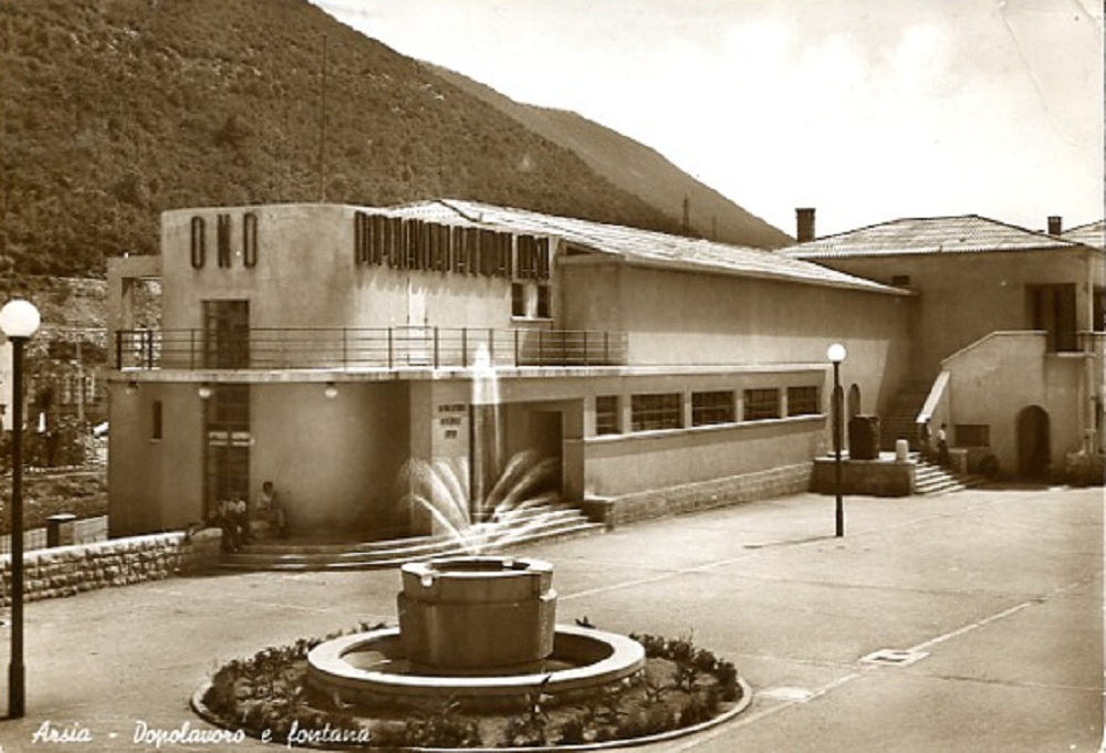
The cinema-theatre complex and fountain make the town look civic rather than temporary. That was deliberate. Raša was planned for roughly 2,000 to 3,000 residents and supplied with a school, kindergarten, hotel, shops, hospital, sports grounds and other services. These amenities improved daily life, but they also organised it. Housing, recreation, administration and production belonged to one company-centred environment.
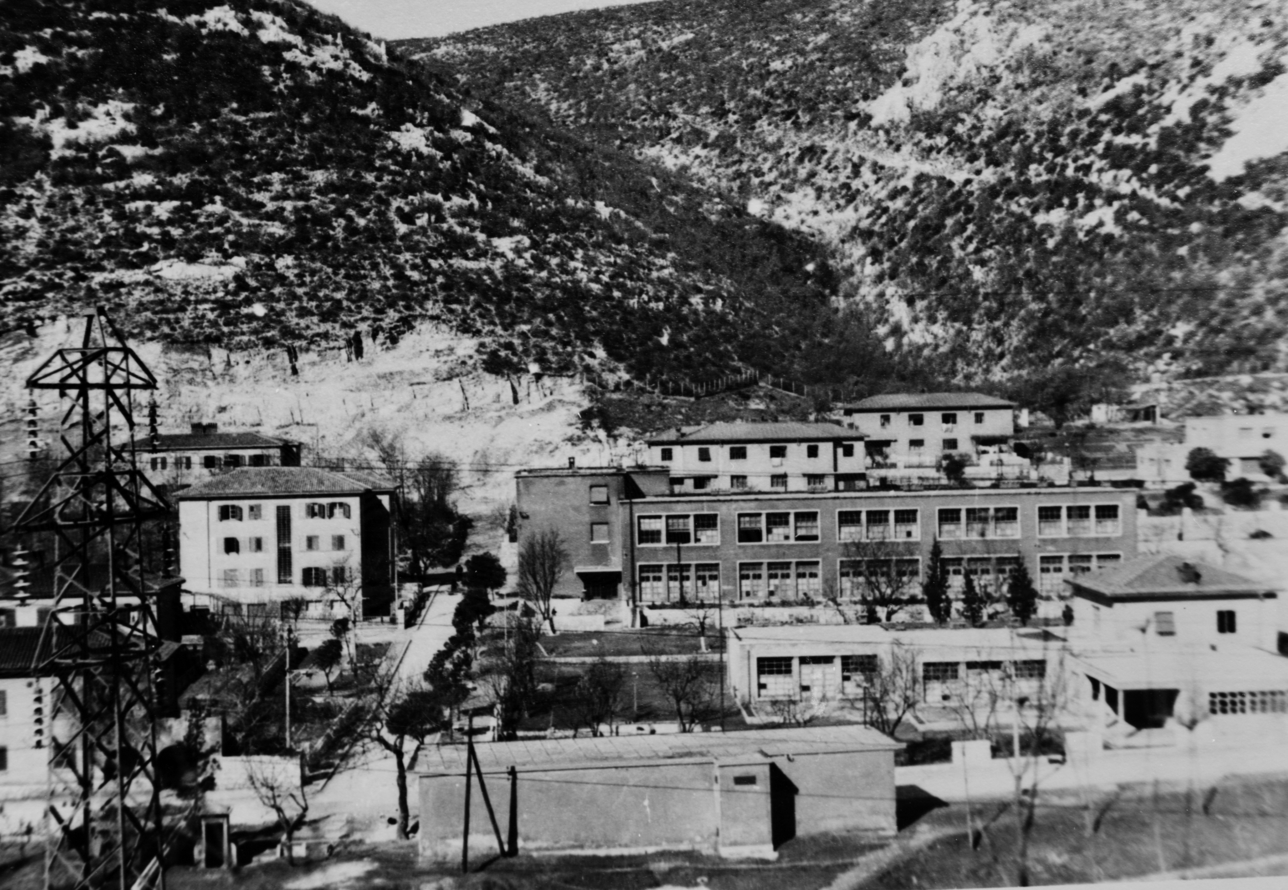
The photograph of the school, kindergarten and housing is particularly revealing because it shifts attention away from monuments. A mining town needed to reproduce a workforce as well as house one. Families, childcare, education and domestic routines were part of the plan. The architecture offered real comfort compared with many improvised industrial settlements, yet it also mapped social rank: workers’ homes and more comfortable housing for officials occupied distinct zones.
7–8: The Square Turned Mining into Architecture
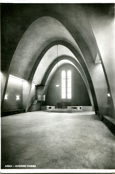
St Barbara’s Church translates the mine into religious space. Its reinforced-concrete ribs evoke underground supports, while the attached square bell tower has long been read as a miner’s lamp. The interior photograph makes the idea clearer than an exterior postcard: repeated arches produce a tunnel-like rhythm, but high windows and pale surfaces turn the structure toward light.
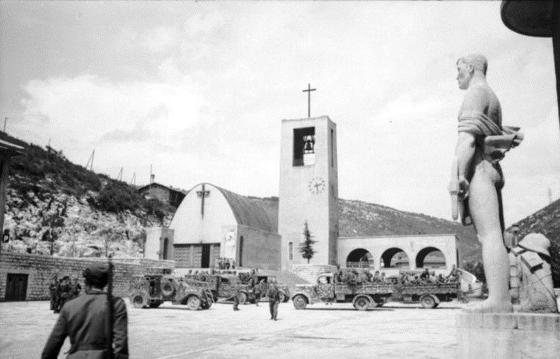
The archive identifies this square scene with the 1944 German occupation. It is a difficult photograph because the familiar church and miner statue become a stage for military vehicles and troops. The planned square was never merely decorative; it concentrated public life and therefore concentrated political display. After the war, symbols changed again. The miner-warrior sculpture by Marcello Mascherini was destroyed in the immediate post-war period, leaving photographs to preserve a feature no longer present.
For the wider story of organised miners and political resistance in the same coalfield, read about the 1921 Labin Republic. Its revolt predates the town of Raša, but it belongs to the labour memory that later residents inherited.
9–13: Coal Moved Through a Network, Not a Single Mine
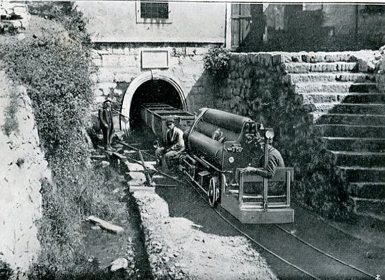
The locomotive emerging from Leone-Clement is compact, specialised and almost entirely defined by the width of the portal. Underground transport depended on machines adapted to confined, dangerous spaces. The workers beside it provide scale: this was not picturesque railway travel but part of a tightly sequenced production chain.
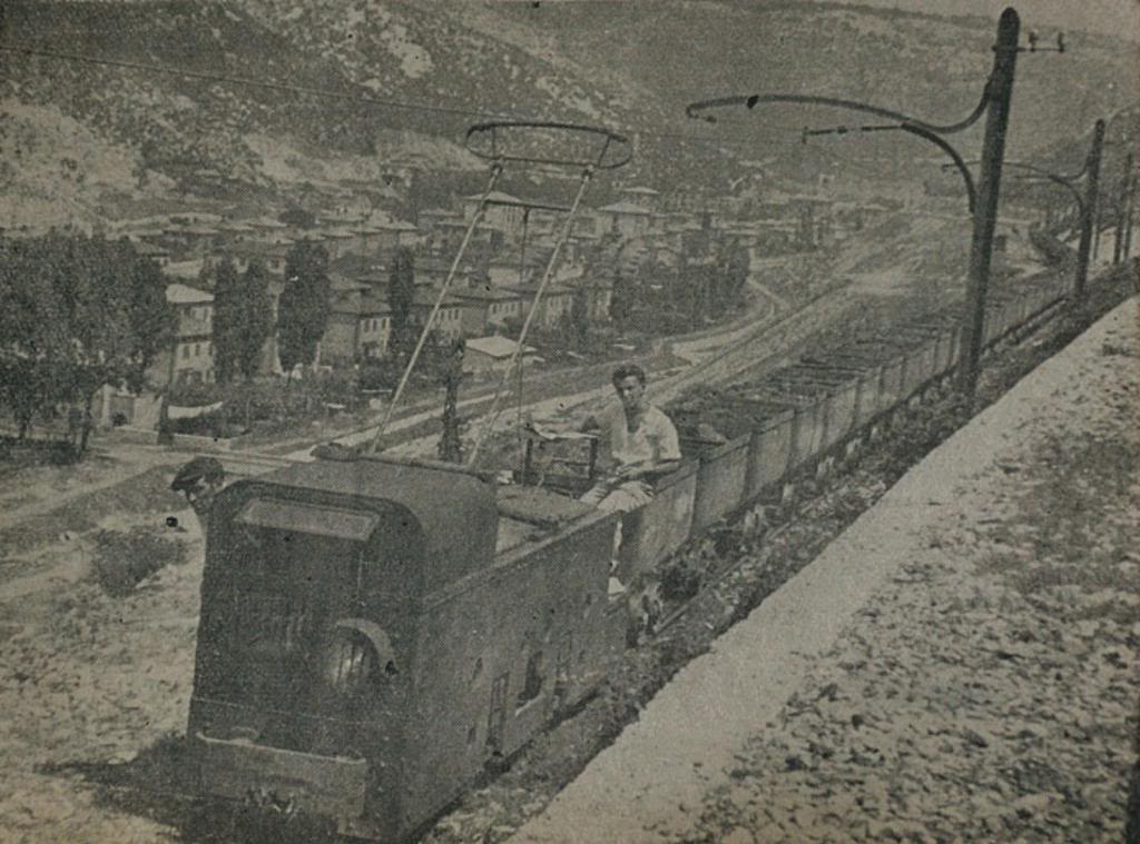
Above ground, the narrow-gauge railway stitched mines, settlements and processing areas together. In the photograph, the town becomes background infrastructure while the locomotive and overhead wire dominate the foreground. It reverses the usual tourist hierarchy: architecture is context, movement is the subject.
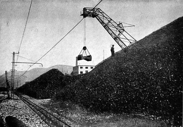
Coal did not travel directly from the face to a ship. It had to be moved, separated, sorted and loaded. The Štalije image brings manual labour back into a process often described only through production totals. Material passes through machinery, but hands still inspect and direct it.
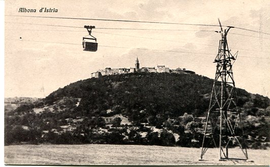
The cableway adds a vertical layer to the transport map. Rails followed workable grades; suspended buckets could cross difficult terrain more directly. Together with locomotives, sorting plants and port machinery, it reveals the coalfield as a landscape-scale machine.
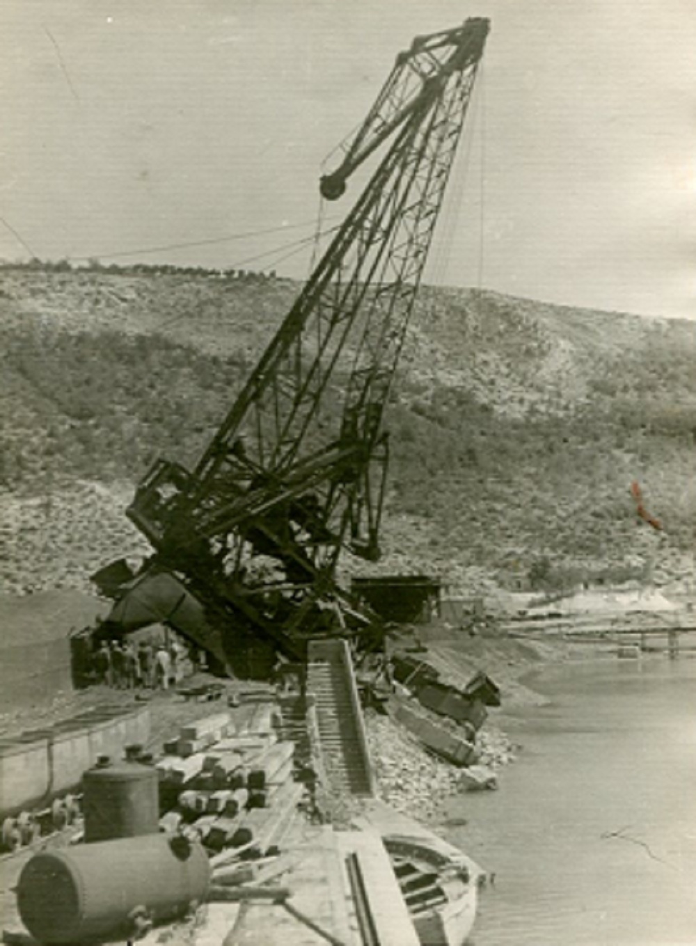
At Bršica, coal met maritime transport. The archive labels this image as the port after bombing: the tilted crane is both industrial equipment and evidence of the network’s strategic importance. Today the Raša Bay feels quiet from places such as the fishing harbour of Trget, but the archive restores the heavy movement of material that once connected the valley to distant markets.
14–16: The Workers Are Not Background Figures
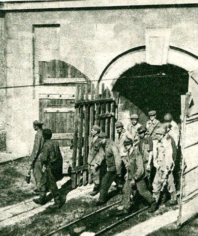
The 1950s image of men leaving the pit breaks the clean lines of the architectural archive. Clothing is dirty, bodies are tired and the narrow exit compresses the group. No production graph can replace this photograph. Coal was measured in tonnes, but produced in bodies, shifts and risk.
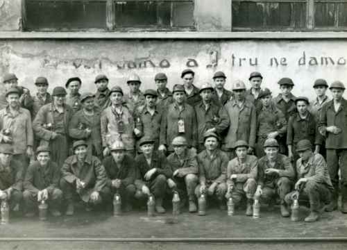
A posed group outside the entrance serves another purpose. It records belonging: crews, colleagues and a shared occupation. Some faces are clear and others nearly dissolve into the print, but the collective remains the subject. When historic mining is presented only through machines, this social structure disappears.
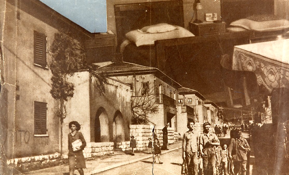
The collage, labelled as material for a 1950s newspaper report, reminds us that archives contain edited narratives as well as individual frames. Someone selected these views to explain mining Raša to an audience. The layout creates energy and abundance, but it also guides interpretation. Ask what it celebrates, what it omits and which images were never chosen.
To understand how mining memory is interpreted nearby today, pair Raša with the mining collection and tunnel at Labin Museum. The museum provides objects and an underground spatial impression that photographs alone cannot.
17–19: Socialism Reframed the Same Streets
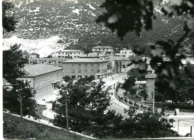
After 1945, Raša’s political frame changed completely, while its urban frame remained. The official municipal history describes a paradox: the town’s fascist origin encouraged neglect, yet coal made the place economically valuable. Socialist-era panoramas therefore show both continuity and reinterpretation. The same housing blocks and axis remain, but the town belongs to a different state, economy and public story.
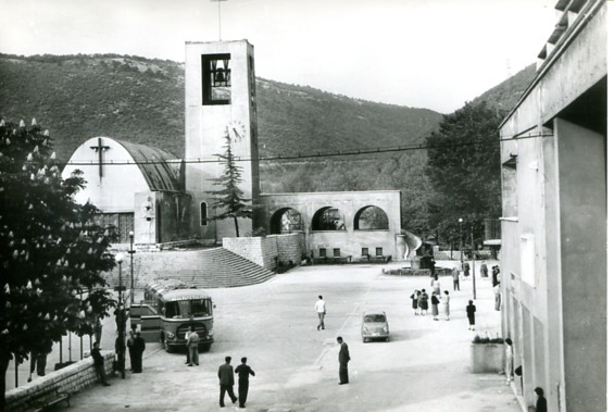
The square now looks used rather than inaugurated. Vegetation is fuller, surfaces have aged and the pristine architectural presentation has given way to everyday life. This is not a decline from a perfect original; it is what happens when a designed image becomes a lived town.
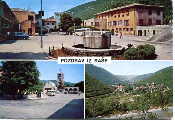
A late-1960s postcard returns the town to promotional form. Compare it with the 1937 panorama: both select an orderly overview, yet they sell different meanings. The first announces newness and control; the later card presents an established community. The Raša pit had closed in 1966, although mining elsewhere in the Labin basin continued. The town was beginning to outlive the specific industrial arrangement that created it.
20: What the Archive Teaches You to See Today
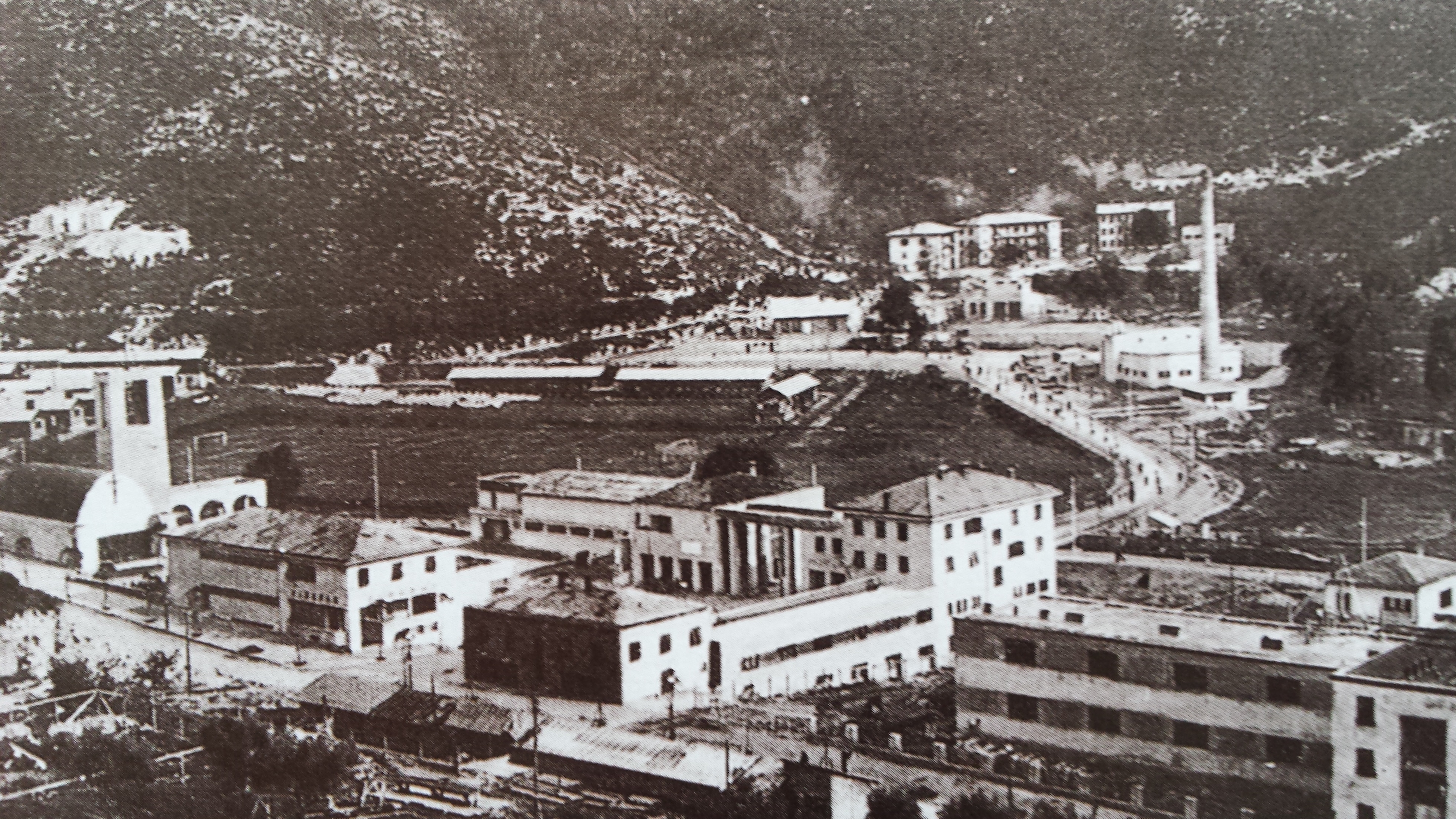
The final photograph is the most recent and, at first glance, the least dramatic. That is precisely why it belongs here. Once you have seen the earlier images, the long housing blocks, central axis, slopes and industrial edge stop being anonymous. The archive supplies a second exposure beneath the first.
Visit Raša with time to walk rather than simply photograph the church and leave. Begin at the square, compare the civic buildings, look along the worker-housing streets, and notice how quickly the mine administration and portal enter the town’s edge. Do not enter closed industrial structures or mine areas without an authorised visit. Historic photographs can tempt you to recreate a viewpoint that is now private, unsafe or inaccessible; the matching angle is never worth that risk.
For a wider regional sequence, continue with Labin’s transformation from coal to culture. Together, the two towns show different afterlives of the same coalfield: one has become closely associated with art and heritage tourism, while the other still reads like a complete industrial town waiting to be understood on its own terms.
Frequently Asked Questions
Is Raša an abandoned town?
No. Raša is a living municipal centre, not an open-air set or abandoned industrial complex. Respect homes, workplaces, religious services and private property while exploring its architecture.
Can you visit the Raša mine?
Authorised underground experiences have been developed in the former mine, but access is controlled and arrangements can change. Check current information with the Municipality of Raša or the official destination service rather than approaching a portal independently.
How long should you allow for the town?
Allow at least 60–90 minutes for a slow exterior walk of the square, church, housing streets and mining edge. Add more time if you have a confirmed heritage-centre or underground visit.
Where can you learn more about the photographs?
Start with local heritage interpretation in Raša and the mining collections in Labin. Archive captions are valuable clues, but published local histories and museum records are better for confirming dates, people and technical details.
Final Thoughts
Raša’s most famous photograph is always some version of the overview: a complete town set against a bare valley. Twenty images change the scale of the story. They reveal earlier mines, family infrastructure, designed symbolism, wartime occupation, transport machinery, exhausted workers, socialist continuity and the slow separation of buildings from their first purpose.
The result is less tidy than the single origin story, and more honest. Raša was designed in one concentrated act, but it was made and remade by the people who worked, raised families, changed governments, maintained buildings and remembered what disappeared. The town is not only an artefact of 1937. It is an archive you can still walk through.